
How satellite data helps track climate change stands out as one of the most transformative tools available to scientists, policymakers, and everyday citizens who care about our planet’s health. From the vast expanse of space, these orbiting instruments deliver a continuous, global picture of shifting temperatures, melting ice sheets, and rising greenhouse gas levels that ground-based sensors could never achieve alone. Consider this: satellite records show that global sea levels have risen more than 100 millimeters since 1993, with the pace accelerating in recent years due to contributions from polar ice loss and ocean warming. This kind of precise, long-term monitoring has changed how we understand climate dynamics and has become indispensable for shaping international agreements like the Paris Accord. In the following sections, we will break down the science behind these technologies, explore real-world applications across polar regions and beyond, and examine how the data drives everything from carbon credit verification to urgent policy decisions. Whether you are a STEM student analyzing trends, a professional advocating for environmental solutions, or a curious citizen scientist eager to dig deeper, this overview will equip you with clear insights into why space-based observation matters now more than ever.
The Basics of Remote Sensing and Earth Observation Satellites
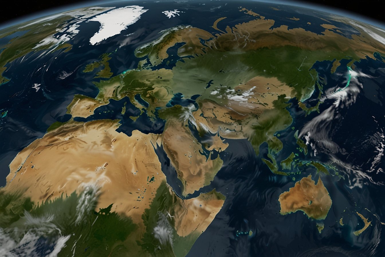
To appreciate how satellite data helps track climate change, it helps to start with the fundamentals of remote sensing. At its core, remote sensing involves collecting information about Earth from a distance using sensors that detect electromagnetic radiation across different wavelengths. Satellites in low Earth orbit or geostationary positions circle our planet multiple times each day, capturing snapshots that reveal subtle changes invisible to the naked eye.
These instruments come in several forms. Optical sensors record visible light and infrared radiation to map vegetation health or surface temperatures. Radar systems, which bounce microwave signals off the ground, work day or night and penetrate clouds, making them ideal for monitoring remote or stormy areas. Lidar uses laser pulses to measure heights with pinpoint accuracy, while spectrometers break down light into its component wavelengths through spectroscopic analysis to identify specific gases in the atmosphere.
NASA, the European Space Agency (ESA), and international partners like JAXA have built fleets of dedicated Earth observation satellites over decades. Early weather satellites from the 1960s laid the groundwork, but today’s missions focus squarely on climate variables. Programs such as ESA’s Copernicus initiative provide free, open-access data that anyone can explore, democratizing access for researchers and citizen scientists alike.
How Satellites Measure Greenhouse Gases and Atmospheric Changes
One of the most critical ways satellite data helps track climate change involves pinpointing sources and levels of greenhouse gases. Carbon dioxide and methane trap heat in the atmosphere, and satellites now detect their concentrations with remarkable precision.
For example, NASA’s Orbiting Carbon Observatory-2 (OCO-2) uses spectroscopic analysis to map CO2 plumes from cities, power plants, and wildfires. Similarly, ESA’s Sentinel-5P satellite, equipped with the TROPOMI instrument, excels at spotting methane leaks from oil and gas operations or agricultural sources. These detections happen in near real time, allowing authorities to respond quickly to major emissions events.
This capability extends to using satellites for methane leak detection in hard-to-reach industrial sites. In polar regions, where ground access is limited, the same technology reveals how thawing permafrost releases additional methane, creating dangerous feedback loops that amplify warming. Data from these missions feeds directly into global inventories, helping verify national emissions reports and supporting carbon crediting systems that reward genuine reductions.
Monitoring Polar Ice Melt, Sea-Level Rise, and Ocean Dynamics
Satellite data shines brightest when it comes to tracking changes in Earth’s frozen regions. How satellite data helps track climate change in polar regions has proven especially eye-opening, revealing rapid transformations that affect the entire globe.
Missions like NASA’s ICESat-2 and ESA’s CryoSat-2 use laser and radar altimetry to measure ice thickness and elevation changes across Greenland and Antarctica. These measurements show that the Greenland ice sheet alone has lost hundreds of gigatons of ice annually in recent years, directly contributing to sea-level rise. Combined with data from the Copernicus Sentinel-6 mission, scientists calculate that oceans are rising at roughly 3.7 millimeters per year on average, a rate that threatens coastal communities worldwide.
Thermal infrared imaging further captures ocean surface temperatures and currents, while gravity-sensing satellites like GRACE-FO detect shifts in water mass distribution caused by ice melt. Together, these tools paint a comprehensive picture of how polar warming influences weather patterns far beyond the poles, including stronger storms and altered rainfall distribution.
Detecting Deforestation, Land Use Changes, and Ecosystem Shifts
Forests act as vital carbon sinks, yet they are disappearing at alarming rates. Satellite imagery has revolutionized our ability to monitor this loss in real time. Programs such as NASA’s Landsat and ESA’s Sentinel-2 series provide high-resolution views that distinguish between healthy vegetation and cleared land, even in dense tropical canopies.
This remote sensing approach plays a key role in satellite imagery for carbon credit verification. Companies and governments use the data to confirm that reforestation projects actually sequester carbon as claimed, ensuring the integrity of voluntary carbon markets. In regions like the Amazon or Southeast Asia, repeated satellite passes reveal not just the extent of deforestation but also the drivers behind it, from agriculture to illegal logging.
Beyond forests, these observations track broader ecosystem changes, including shifts in agricultural productivity and biodiversity hotspots. By integrating multiple data layers, scientists identify climate feedback loops where warming leads to drier soils, more fires, and further carbon release.
The Impact on Climate Models, Policy Decisions, and Global Action
All this raw data feeds into sophisticated climate models that predict future scenarios with greater confidence. NASA uses satellite inputs to refine forecasts of extreme events, while ESA’s Climate Change Initiative turns decades of observations into consistent records of essential climate variables.
Policymakers rely on these insights for everything from updating national adaptation plans to negotiating international treaties. For instance, satellite-derived evidence of accelerating ice melt has strengthened calls for stronger emissions targets. In the private sector, the data supports due diligence on climate risks for investments and insurance.
Citizen scientists also benefit. Online portals from NASA and Copernicus let anyone view live imagery of wildfires, floods, or ice extent, fostering broader public engagement and informed advocacy.
Challenges Facing Satellite Climate Monitoring and What Lies Ahead
Despite its strengths, satellite monitoring faces hurdles. Cloud cover can obscure optical views in some regions, and data volumes are massive, requiring advanced processing. International collaboration helps overcome gaps, as seen in joint NASA-ESA missions.
Looking forward, new technologies promise even better results. Upcoming launches will feature improved resolution and additional sensors focused on water cycles and aerosols. Artificial intelligence will sift through petabytes of data faster, spotting trends that humans might miss. These advances will make satellite data an even more powerful ally in the fight against climate change.
In summary, how satellite data helps track climate change goes far beyond pretty pictures from space. It delivers actionable intelligence that shapes our response to a warming world. By understanding these tools and the stories they tell, we gain both knowledge and hope. Explore open data portals from NASA or ESA yourself, share what you learn, and consider supporting organizations that champion continued investment in Earth observation. Our planet’s future depends on the clarity these satellites provide, and the actions we take with that knowledge.
FAQ
What exactly is remote sensing and why is it important for climate tracking?
Remote sensing refers to gathering information about Earth’s surface and atmosphere from satellites or aircraft without physical contact. It is important for climate tracking because it provides consistent, global coverage of hard-to-reach areas like the poles or deep oceans, delivering data on temperature, gases, and ice that ground stations cannot match alone.
Which satellites are primarily used to monitor greenhouse gases like CO2 and methane?
Key satellites include NASA’s OCO-2 and OCO-3 for carbon dioxide mapping and ESA’s Sentinel-5P with its TROPOMI instrument for methane detection. These tools use spectroscopic analysis to identify gas concentrations and pinpoint emission sources worldwide.
How do satellites help measure sea-level rise and polar ice changes?
Satellites equipped with radar and laser altimeters, such as Copernicus Sentinel-6 and NASA’s ICESat-2, measure ocean surface height and ice thickness. This data has documented sea-level increases of about 3.7 millimeters per year in recent decades and tracks rapid ice loss in Greenland and Antarctica.
Can satellite data detect methane leaks from industrial sources?
Yes, satellites like Sentinel-5P and specialized missions such as MethaneSAT identify large methane plumes in near real time. This capability supports using satellites for methane leak detection, helping regulators and companies address emissions quickly and accurately.
How is satellite imagery used for verifying carbon credits and deforestation projects?
High-resolution images from Landsat and Sentinel satellites monitor forest cover changes over time. They allow independent verification that reforestation or avoided deforestation projects actually store carbon, building trust in carbon credit markets and supporting transparent reporting.
What role do satellites play in understanding climate feedback loops?
Satellites track variables like water vapor, soil moisture, and vegetation health that influence feedback loops. For example, data from instruments like AIRS reveal how warming increases atmospheric moisture, which in turn amplifies the greenhouse effect.
Are satellite climate records accurate enough for global policy decisions?
Satellite records undergo rigorous calibration and cross-validation with ground data, making them highly accurate for long-term trends. Organizations like NASA and ESA use them to inform IPCC assessments and national climate policies because they offer unbiased, repeatable global measurements.
What future improvements can we expect in satellite-based climate monitoring?
New missions will bring higher resolution, more frequent observations, and advanced AI processing. International partnerships are expanding coverage of under-monitored regions, ensuring even better support for adaptation strategies and emissions reductions in the coming years.
How can students or citizen scientists access and use satellite climate data?
Free platforms from NASA Earthdata and ESA’s Copernicus allow anyone to download imagery and datasets. Tutorials on these sites guide users in analyzing changes in sea ice, forests, or gas levels, making professional-grade tools available for education and personal projects.
Why is international collaboration essential for satellite climate programs?
No single country can cover the entire planet alone. Joint efforts between NASA, ESA, and others share technology, data, and costs, creating a complete picture of climate change while ensuring open access that benefits global research and policy efforts.
YOU MAY ALSO LIKE: Global Climate Change Updates 2026: What You Need to Know